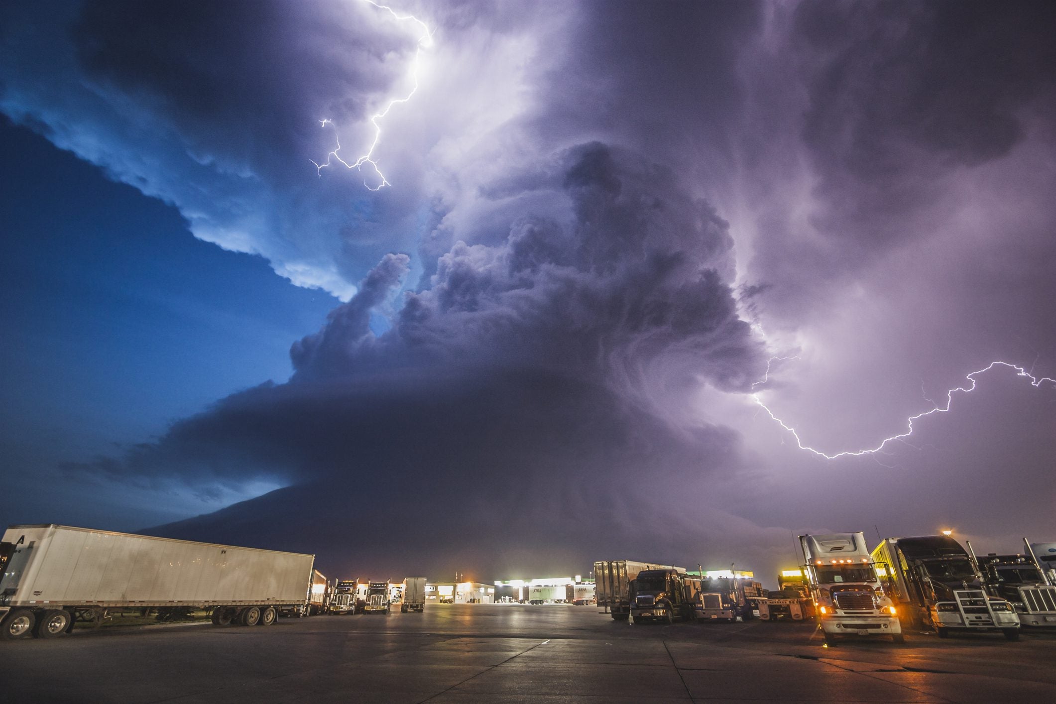
Hurricane Season officially starts this week. If you live in a hurricane evacuation zone, now’s the time to replenish hurricane emergency supplies and prepare your home for the coming hurricane season. The National Oceanic and Atmospheric Administration (NOAA) website has an 8-step plan to guide you through the process.
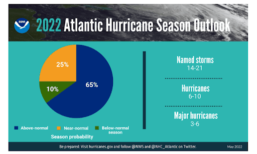
The Atlantic hurricane forecast calls for another above-average hurricane season in 2022, according to Forecasters at NOAA’s Climate Prediction Center. NOAA’s outlook for the 2022 Atlantic hurricane season predicts a 65% chance of an above-normal season, a 25% chance of a near-normal season, and a 10% chance of a below-normal season. NOAA is forecasting a likely range of 14 to 21 named storms (winds of 39 mph or higher), of which 6 to 10 could become hurricanes (winds of 74 mph or higher), including 3 to 6 major hurricanes (category 3, 4 or 5; with winds of 111 mph or higher). NOAA provides these ranges with 70% confidence.
Get the clearest, most accurate view of the truckload marketplace with data from DAT iQ.
For comparison, an average hurricane season in the Atlantic features 14 named storms, seven hurricanes, and three major hurricanes, making the forecast of up to 21 named storms approximately 50% higher than the 1991–2020 average. This hurricane season’s increased activity is attributed to several climate factors, including the ongoing La Niña that is likely to persist throughout the hurricane season, warmer-than-average sea surface temperatures in the Atlantic Ocean and the Caribbean Sea, weaker tropical Atlantic trade winds, and an enhanced west African monsoon. An enhanced west African monsoon often correlates with many of the strongest and longest-lived hurricanes during most seasons.
The Central Pacific region expects to see a quieter storm season this year
In the Central Pacific, there is a 60% chance of below-normal tropical cyclone activity during the hurricane season this year, according to NOAA’s Central Pacific Hurricane Center and NOAA’s Climate Prediction Center. The outlook also indicates a 30% chance for near-normal activity and only a 10% chance of an above-normal season. According to Matthew Rosencrans, NOAA’s lead seasonal hurricane forecaster, “this year we predict less activity in the Central Pacific region than regular seasons. The ongoing La Niña is likely to cause strong vertical wind shear making it more difficult for hurricanes to develop or move into the Central Pacific Ocean.”
How accurate are NOAA’s forecasts anyway?
According to NOAA, after the 2021 Atlantic hurricane officially ended on Nov. 1, the season produced 21 named storms (winds of 39 mph or greater), including seven hurricanes (winds of 74 mph or greater), of which four were major hurricanes (winds of 111 mph or greater). The above-average 2021 hurricane season was accurately predicted by NOAA in their May and August outlooks and was the third most active year on record in terms of named storms. In addition, the NOAA report noted that 2021 was the sixth consecutive above-normal Atlantic hurricane season and was the first time that two successive hurricane seasons exhausted the list of 21 storm names.
2021 was also in the top 5 costliest seasons
The 2021 Atlantic season will likely go down as one of the most expensive in history. Total damages from last year’s Atlantic hurricane season are expected to cost over $67 billion, with four tropical cyclones exceeding $1 billion in damages. Hurricane Ida, which hit the Louisiana coast in August 2021, was the most destructive and deadly tropical cyclone last year, causing $64.5 billion in damage and 96 deaths.
“Hurricane Ida spanned nine states, demonstrating that anyone can be in the direct path of a hurricane and in danger from the remnants of a storm system,” said FEMA Administrator Deanne Criswell. “It’s important for everyone to understand their risk and take proactive steps to get ready now by visiting Ready.gov and Listo.gov for preparedness tips and downloading the FEMA App to ensure you receive emergency alerts in real-time.”
What’s the big takeaway for carriers, brokers and shippers?
As always, expect the unexpected and be prepared to be surprised. As we’ve always said, stay tuned to the Weather Channel as supply and demand follow a predictable pattern before and after hurricanes in the Atlantic Ocean. Before hurricanes and or storms make landfall, inbound demand spikes as supplies are positioned in advance, capacity evaporates as carriers seek safer ground, and outbound demand surges as shippers look to move freight out of harm’s way. The reverse happens post-landfall. We expect FEMA to be well-prepared this season and will continue to stage emergency equipment and supplies at sites including Maxwell Air Force Base in Alabama, ideally located to ship emergency relief within hours of landfall.
In the week ending August 21 last year, inbound flatbed and dry van load post volumes into the Montgomery freight market were almost five times higher before Hurricane Ida made landfall. There’s no reason to think this season will be any different.